Designed for AI, Built for Accessibility
The Next Chapter

of Ultra HD Aerial Imagery
Incredible content, streamed instantly through next-gen web server technology
Join the Waitlist

Ultra HD Aerial Imagery

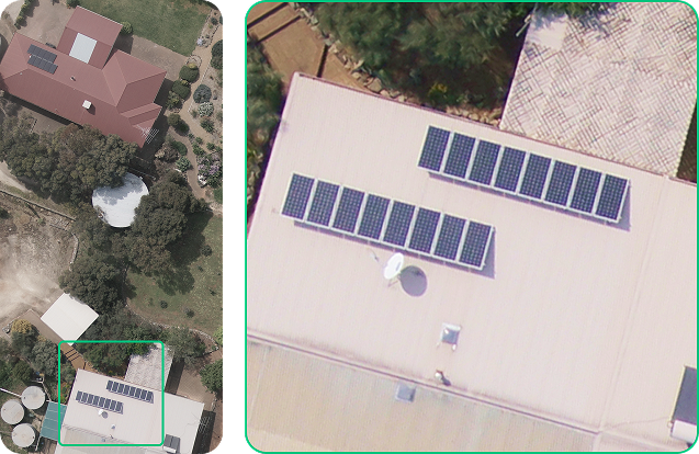
Down to 5 cm pixel resolution with both vertical and oblique views, updated three times a year for unmatched accuracy.

Best-in-class pixel resolutions
Standard top-down and oblique options
Minimum of 3 yearly captures

Non-Restrictive
Licensing & Access

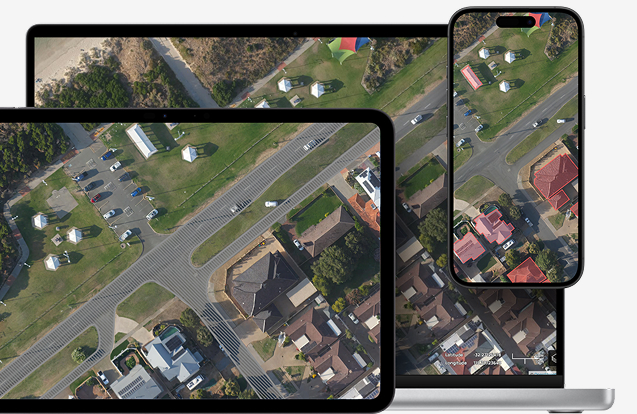
Access instantly on any device —
 no restrictive licenses or hidden limits.

Free to access
Seamless mobile and desktop experience
In-built API availability for 3rd party software including various CAD and GIS platforms

Advanced Tools & Analytics

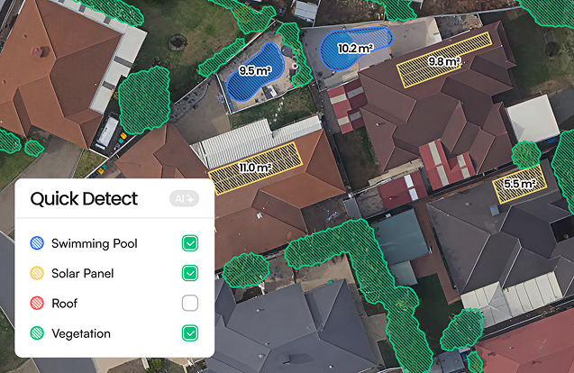
Turn raw imagery into insights with built-in AI measurement tools,
3D visualization, and map editing. Preloaded AI copilot that works just like ChatGPT.

Measure, analyze, add photos, create new maps
AI-powered image extraction and and 3D viewing
Built on Soar’s
Proven Global Platform
For streaming the worlds maps and imagery —
 the foundation behind our scale and speed
Seamless integration
with Soar’s globally scalable
compute and tiling technology
3K+
Contributors worldwide
1M+
Maps ingested
5PB+
Of imagery served
Global reach through
Soar’s open map network
Designed for Scale

and Access
Ultra HD Imagery
Down to 5 cm per pixel for clear details.
Compute Solved
Unlimited viewing with no data caps, or hidden costs.
AI Ready
A mapping feed built for

the Agentic era of AI.
Open 
Access
Free, web-based viewer with
pay-as-you-grow features.
Affordable,
Frictionless Access
For both everyday users and industry professionals alike
Solar
Security
Local Government
Tourism
Insurance
Real Estate
Construction
News Media
Gardeners
Get Early

Access
Be among the first to access

next-generation aerial imagery and tools
Thank You!
Your submission has been received!
Oops! Something went wrong while submitting the form.